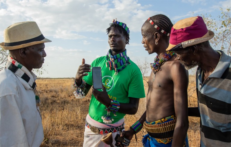
Afriscout’s colonel helps users navigate the app.Credit: Afriscout
As resource scarcity and food insecurity intensify across Africa, precision agriculture—driven by technologies like the Internet of Things (IoT), drones, GPS mapping, remote sensing, and artificial intelligence (AI)—is revolutionizing agricultural practices. This innovative approach is reshaping how food is cultivated, monitored, and managed throughout the continent.
Abdel Aziz Belal, president of the African Precision Agriculture Association and head of the Agro-Applied Soil and Marine Department at Egypt’s National Authority for Remote Sensing and Space Sciences (NARSS), posits that these advanced agricultural technologies are pivotal for Africa’s sustainable future. He asserts that technology plays a crucial role in identifying changes in crops, determining their causes, and proposing viable solutions.
Belal highlights that technology can facilitate pest detection, yield estimation, and the precise assessment of agricultural inputs needed in soil—right when and where they are required. He emphasizes that smart irrigation systems, which utilize wireless sensors and satellite data, are particularly beneficial for drought-prone regions. “This technology greatly reduces water waste,” he notes.
These innovations are already making waves across Africa. In Nigeria, drone entrepreneur Femi Adekoya, dubbed the “Flying Farmer,” is leveraging drone technology to monitor crops and educate others on advanced agricultural techniques. In Kenya, traditional pastoralists are utilizing satellite technology to locate optimal grazing lands. Pamela Paris, a senior researcher at Kenya’s African Plant Nutrition Institute (APNI), is dedicated to ensuring that digital tools are accessible to women farmers, who often find themselves at a disadvantage in technology adoption.
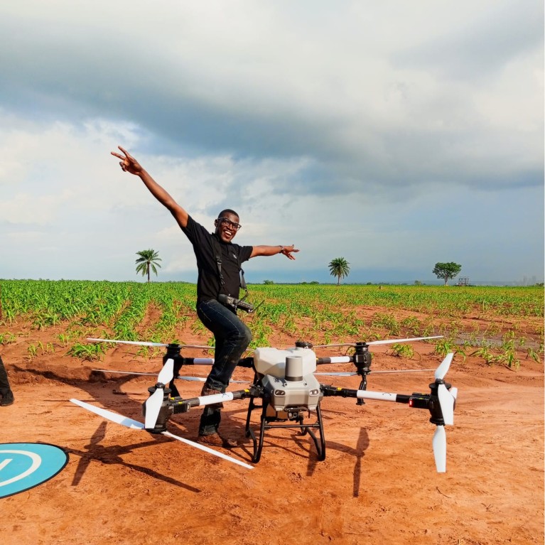
Flying Farmer Femi Adekoya.Credit: Femi Adekoya
Femi Adekoya Leads the Charge in Precision Agriculture
Adekoya is a renowned Nigerian agricultural expert who provides cutting-edge technological solutions to farmers, driving the shift towards digital farming across Africa. As the founder of Integrated Aerial Precision, he offers drone and data technology services tailored for the agriculture sector. He also established the Precision Field Academy, which aims to educate and train professionals in emerging agricultural technologies such as drones, Geographic Information Systems (GIS), remote sensing, and AI.
After training as a drone pilot, Adekoya recognized the potential of his skills to revolutionize farming in Nigeria. He believes that embracing smart agricultural solutions is essential for sustainably feeding a growing population. “Continuous monitoring allows farmers to make data-driven decisions regarding fertilizer use and pest management,” he explains, stressing the importance of quick responses to crop stressors. By replacing manual reconnaissance—which is often labor-intensive and prone to errors—drones provide rapid, accurate data across large areas.

Pamela Paris.Achievement of Pamela Paris.
Pamela Paris Advocates for Women’s Empowerment in Agriculture
Pamela Paris serves as a senior researcher at the African Plant Nutrition Institute (APNI) in Kenya, where her work focuses on addressing challenges related to climate change, agricultural production, and gender equality. She asserts that achieving precision agriculture in Africa requires empowering women farmers, who face numerous challenges that hinder their productivity. These barriers include limited access to resources, insufficient information, and a lack of decision-making authority.
The 2024 Afrobarometer Uganda report reveals that only 16% of registered land is owned by women despite their significant role in agriculture, which can reach up to 75% in some areas. Many women also struggle with access to agricultural services that are vital for innovation. Furthermore, a lack of digital literacy and access to technology restricts their ability to capitalize on valuable agricultural insights.
Paris emphasizes that integrating digital solutions—like advisory services, financial tools, and online marketplaces—can help alleviate many of these obstacles. However, effective implementation necessitates collaboration across various sectors. Her research also involves developing monitoring and evaluation systems to enhance precision agriculture projects, a task complicated by institutional limitations on data collection.
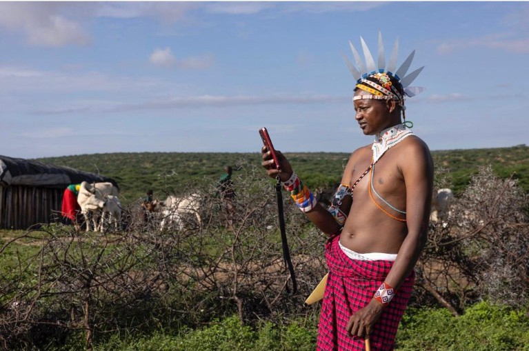
A Samburu user checks the app before heading out to pasture.Credit: Afriscout
Omar Madera Harnesses Technology with Traditional Knowledge
An innovative application designed for East African pastoralists integrates satellite data, indigenous knowledge, and community-sourced insights to assist pastoralists in locating pasture and water resources. Omar Madera, a pastoralist from Samburu County, Kenya, remarked on the app’s impact: “Before we got AfriScout, we were losing a lot of animals. Now we can decide where to move next, knowing exactly where the pasture and water are.”
Developed by Project Concern International, the application proved its efficacy by offering paper-based vegetation maps to pastoralist communities in Ethiopia. Within a year, 80% of users reported using these maps for migration decisions, resulting in an average 47% reduction in herd mortality. Traditional scouting methods have become less effective amid climate change and reduced rangelands, leading to increased competition for resources.
Tyren Ododa, a community engagement associate at AfriScout, highlights that traditional scouting methods fail to address the rapid environmental changes. The app employs detailed satellite imagery to monitor vegetation conditions and surface water availability, allowing users to track crop and water resources in near real-time.
This technology significantly reduces the time needed for scouting, conservatively saving families nearly three days per trip. Beyond improving livestock health, the app also mitigates conflicts over grazing land and enhances decision-making regarding migration. Designed to function on unreliable 3G networks, the application quickly updates maps and allows users to access information without internet connectivity, all while embedding local rangeland boundaries.
Pastoralists can also post geo-tagged alerts about issues such as disease threats, wildlife encounters, and land blockages, providing valuable information for other users in the vicinity.